AI Spatial Asset Management & Automated Inspection.
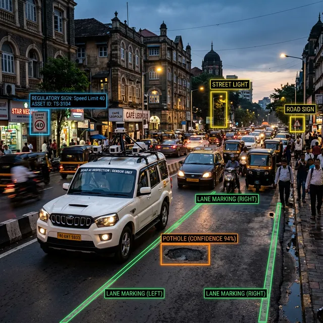
We train machine learning models on geo-referenced spatial data to automate asset detection, condition scoring and predictive maintenance, with every model scored against manually inspected reference data and reviewed by an engineer before it becomes a deliverable. Our road condition models are aligned with methodologies required by authorities like the National Highways Authority of India (NHAI).
How we measure accuracy
Each model is scored against manually inspected reference data and, where we can, against LiDAR ground truth. Results are reported per defect class and per road condition, not as a single headline number, and every AI flag is confirmed by an engineer before it reaches a report or work order.
What We Do
From automated road condition scoring and utility asset inventories to predictive maintenance models and custom ML deployments, our AI capability turns spatial survey data into actionable infrastructure intelligence.
Road Asset Inventory & Condition Scoring
Detection and segmentation models, combined with multimodal foundation models for roadside asset classification, work on geo-referenced road imagery and LiDAR data to find pavement defects, potholes, cracking, rutting, drainage failures. Output: a GIS-linked condition database with severity scoring for evidence-based maintenance budgeting. This capability is productised as GeoSurveyAI.
Utility & Pipeline Asset Management
Detection and inventory of water mains, sewer networks, stormwater drains, and utility nodes from UAV imagery and LiDAR point clouds. Delivered as structured PostGIS databases with spatial coordinates, attribute data, and condition flags.
Predictive Maintenance Models
Time-series ML models built from historical condition data and spatial asset attributes that predict deterioration rates and generate forward-looking maintenance schedules, shifting owners from reactive to predictive maintenance.
Municipal Asset Registries & Custom ML
Structured GIS asset registries covering all municipal infrastructure classes, delivered as a live PostGIS database and web GIS dashboard. We also train client-specific detection models for encroachment, structural damage, or vegetation classification on power lines.
Prefer software to a project?
The same pipelines are available as products you can run yourself or have us run for you.
Technical FAQ
Industrial Intelligence Standards.
Our ML models for infrastructure assessment align with national highway data standards and international spatial computing research.
Ready to make your infrastructure intelligent?
Send us your project brief. We'll get back to you within 24 hours.
Initialize Project