HBIM Explained: How Heritage BIM Preserves Irregular Geometry
HBIM is not standard BIM with a heritage label — it is a modelling method that preserves irregular historic geometry, material stratigraphy, and construction phasing from LiDAR reality capture.
Standard BIM assumes straight walls, plumb columns, and regular grids — because that is how new buildings are designed. Heritage buildings were hand-built over centuries. HBIM starts from LiDAR reality, not design intent, and preserves every irregularity that makes historic fabric significant.
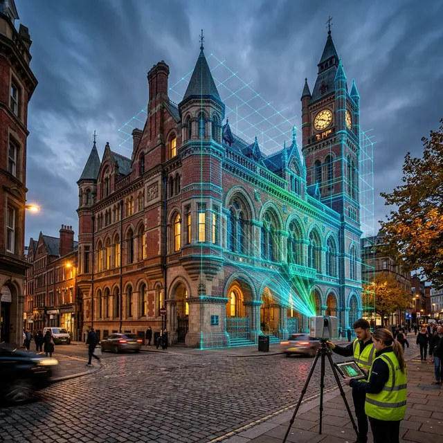
Key takeaways
- HBIM is a survey-first modelling method, not standard BIM with a heritage label: it preserves irregular geometry, material stratigraphy, construction phasing, and condition state from LiDAR reality.
- HBIM-grade capture is demanding — 12–18mm point spacing on detail, physical targets in every station pair, total-station control in constrained GNSS sites.
- Deliverables (classified cloud, orthophotos, LOD 300–350 IFC model, condition schedules, splats) map directly onto ASI and heritage-authority submission requirements.
Why Standard BIM Fails Historic Buildings
A conventional BIM workflow begins with design drawings and ideal geometry. Walls are vertical, arches are circular, and floor levels are constant. That assumption breaks immediately in a heritage structure: walls lean by centimetres over their height, arches are elliptical or segmental from reconstruction, and floor levels step where later interventions raised or lowered them.
Modelling a 19th-century courthouse with standard BIM tools produces a model that is geometrically correct to the design standard but spatially wrong to the building. Structural assessments based on that model will miscalculate load paths. Services routing that assumes plumb walls will clash on site. Regulatory submissions using idealised drawings will be questioned by heritage authorities whose mandate is to protect the fabric as it exists, not as it was designed.
HBIM resolves this by reversing the sequence: survey first, model second, and never idealise.
What HBIM Is
Heritage BIM (HBIM) is a modelling method — not a separate software — that converts classified LiDAR point clouds into parametric Revit or ArchiCAD models while encoding four layers that standard as-built BIM does not:
| Layer | What It Captures | How It Is Built |
|---|---|---|
| Irregular geometry | Leaning walls, non-circular arches, stepped floors, vaulted ceilings | Modelled from section boxes through the point cloud, not from nominal dimensions |
| Material stratigraphy | Stone, lime mortar, timber, later cement repairs, steel insertions | Attributed per element from visual inspection and sample analysis, linked to material libraries |
| Construction phasing | Original build, colonial alterations, post-independence additions | Phased by period, each phase modelled as a separate workset for timeline analysis |
| Condition state | Crack patterns, spalling, moisture damage, structural deformation | Georeferenced condition maps overlaid on orthophotos, linked to condition-rated elements |
The result is a model that a conservation architect can query: show all 1890s load-bearing lime-mortar walls rated condition 3 or worse, or isolate every element altered after 1970.
LiDAR Capture for HBIM — What Changes vs. Standard Scanning
HBIM-grade capture is more demanding than infrastructure scanning:
- Density: Ornament, mouldings, and carved surfaces require higher overlap — typically 12–18mm point spacing on detailed surfaces vs. 20mm for infrastructure.
- Photography: High-resolution photogrammetry runs in parallel with LiDAR for texture. Ornate interiors with polychrome surfaces need structured-light detail in addition to LiDAR intensity.
- Targets: Heritage interiors have few planar surfaces for cloud-to-cloud convergence, so physical targets remain mandatory. Minimum 4 targets per station pair, with at least one vertical offset, to constrain registration in vaulted spaces.
- Control: Heritage sites are often constrained GNSS environments (narrow streets, courtyards). Control is established by total station traverse from a nearby GNSS point rather than direct occupation.
For a full scan of a 2,000 m² heritage structure, expect 40–55 stations over 2 field days — roughly 1.5× the count for an equivalent industrial facility — because every vaulted room needs an overhead position. See our heritage documentation and 3D scanning workflows for the complete sequence from field to deliverable.
Gaussian Splatting — When a Mesh Is Not Enough
A textured mesh from photogrammetry captures geometry well but can appear soft on close inspection of carved stone or polychrome surfaces. Gaussian splatting represents the scene as millions of volumetric ellipsoids, each encoding position, scale, opacity, and view-dependent colour. Rendered in a splat viewer, the result is photorealistic at any distance — capturing the specular behaviour of polished stone and the depth of carved detail that a mesh texture flattens.
We deliver Gaussian splats as .PLY for use in virtual heritage platforms, museum interpretation, and online portals. For engineering analysis, the HBIM model remains the authoritative record; the splat is the audience experience. This separation — model for decision, splat for presence — is central to our digital twin approach for heritage.
HBIM Deliverables and How Authorities Use Them
| Deliverable | Format | Authority / Use |
|---|---|---|
| Registered, classified point cloud | .LAS / .E57, .RCP | ASI submission annexure, archival record |
| Orthophoto set (all facades, plans, sections) | GeoTIFF, PDF 1:50/1:100 | Measured drawing baseline |
| HBIM model (LOD 300–350) | .RVT / .PLN, .IFC | Conservation design, structural assessment, permit submission |
| Condition-rated element schedule | Excel + IFC property sets | Scope of repair, BOQ for conservation works |
| Phased timeline model | Workset-filtered views + report | Impact assessment for proposed alterations |
| Gaussian splat | .PLY + viewer | Museum/exhibition, online heritage portal |
Heritage authorities (ASI, State Archaeology, National Monuments Authority) require measured drawings that reflect the structure as surveyed. An HBIM model structured to IFC property standards serves as a single source of truth — orthophotos, sections, and phased reports all derive from the same verified point cloud, reducing contradictions between submitted documents.
HBIM vs. Standard Scan-to-BIM — A Quick Comparison
| Criterion | Standard Scan-to-BIM | HBIM |
|---|---|---|
| Starting point | Design intent / nominal dimensions | LiDAR point cloud (survey truth) |
| Geometry handling | Orthogonal, idealised | Irregular, as-found |
| Material data | Uniform per type | Stratified per element + phase |
| Condition | Not modelled | Condition-rated, georeferenced |
| Primary user | Contractor, FM team | Conservation architect, structural engineer, heritage authority |
| Regulatory status | Design BIM (new build) | Archival record + permit submission |
HBIM costs more per square metre than standard as-built BIM because it preserves complexity instead of removing it. That complexity is the heritage value. An idealised model is cheaper to produce but expensive to rely on — because the building will contradict it on site.
Frequently Asked Questions
What is HBIM?
Heritage BIM is a modelling method — not separate software — that converts classified LiDAR point clouds into parametric Revit or ArchiCAD models while encoding irregular geometry, material stratigraphy, construction phasing, and condition state that standard as-built BIM does not.
How is HBIM different from standard Scan-to-BIM?
Standard Scan-to-BIM starts from design intent with idealised orthogonal geometry for contractors and FM teams. HBIM starts from the LiDAR point cloud, preserves as-found irregularity, rates every element's condition, and serves conservation architects and heritage authorities as an archival record.
Why does HBIM capture cost more?
Ornament needs 12–18mm point spacing, heritage interiors need physical targets at every station pair, and constrained GNSS sites need total-station traverse control. A 2,000 sqm heritage structure takes 40–55 stations over 2 field days — roughly 1.5x an equivalent industrial facility.
What HBIM deliverables do Indian heritage authorities accept?
A classified point cloud (.LAS/.E57) as archival annexure, GeoTIFF/PDF orthophotos as the measured-drawing baseline, an LOD 300–350 IFC model for conservation design and permits, condition-rated schedules for repair BOQs, and Gaussian splats for museum and portal use.
What is Gaussian splatting in heritage documentation?
A neural rendering method representing the scene as millions of volumetric ellipsoids for photorealistic inspection of carved stone and polychrome detail. The splat is the audience experience; the HBIM model remains the authoritative engineering record.